Dr. Carlos
Fernández
Research interests
Shear
zones
|
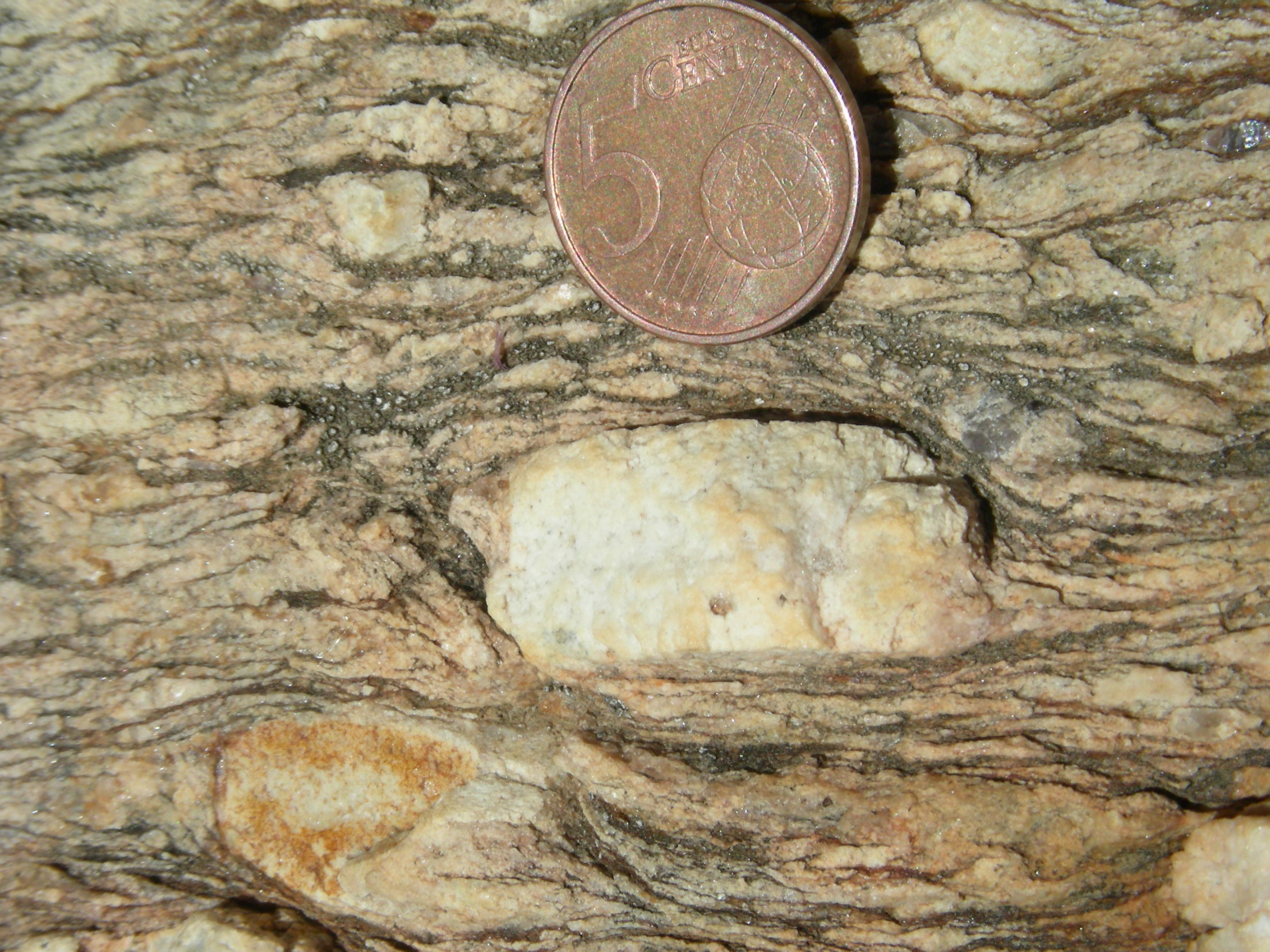
Punta del
Peñón Blanco shear zone (Fuerteventura, Canary Islands).
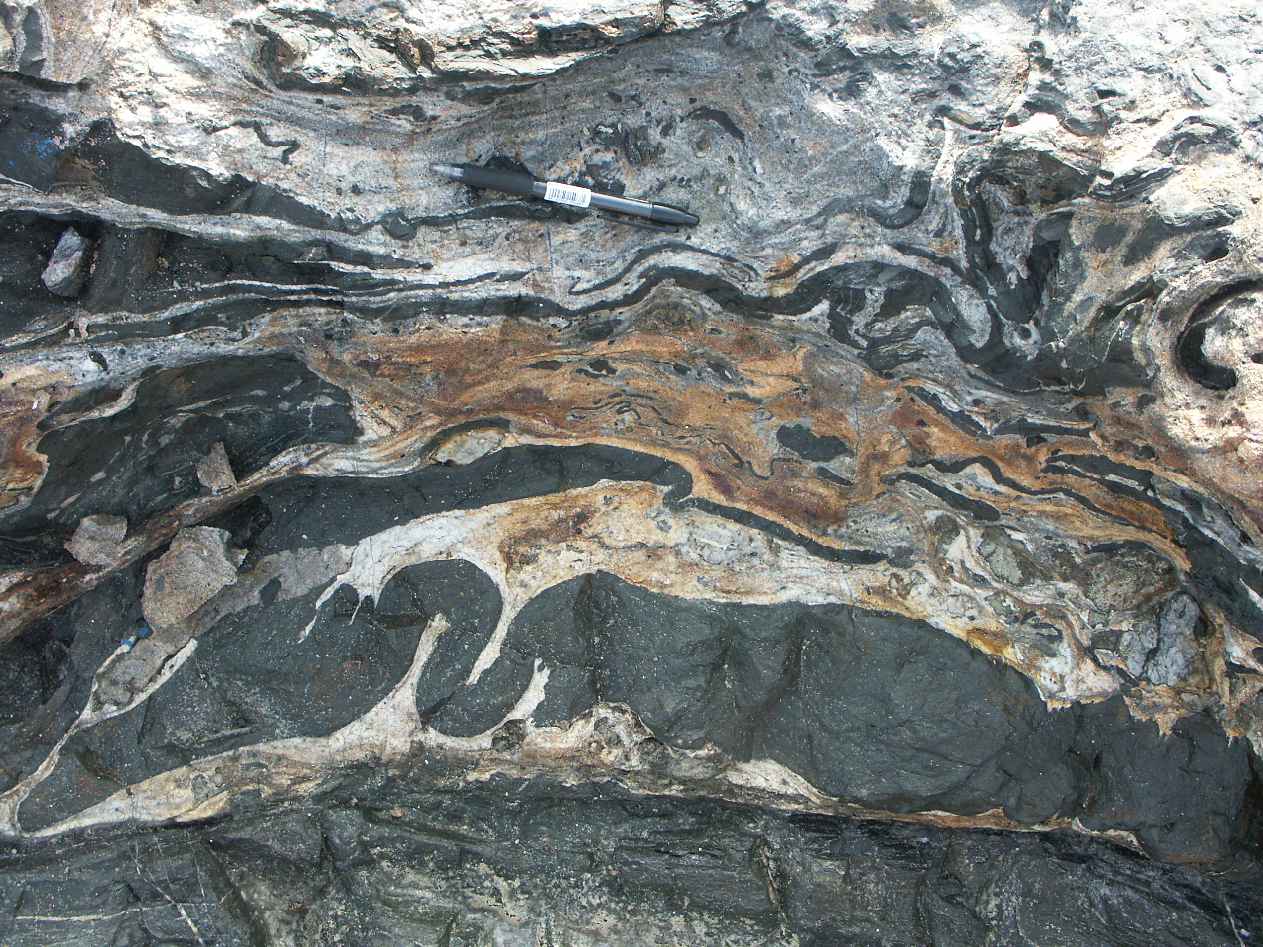
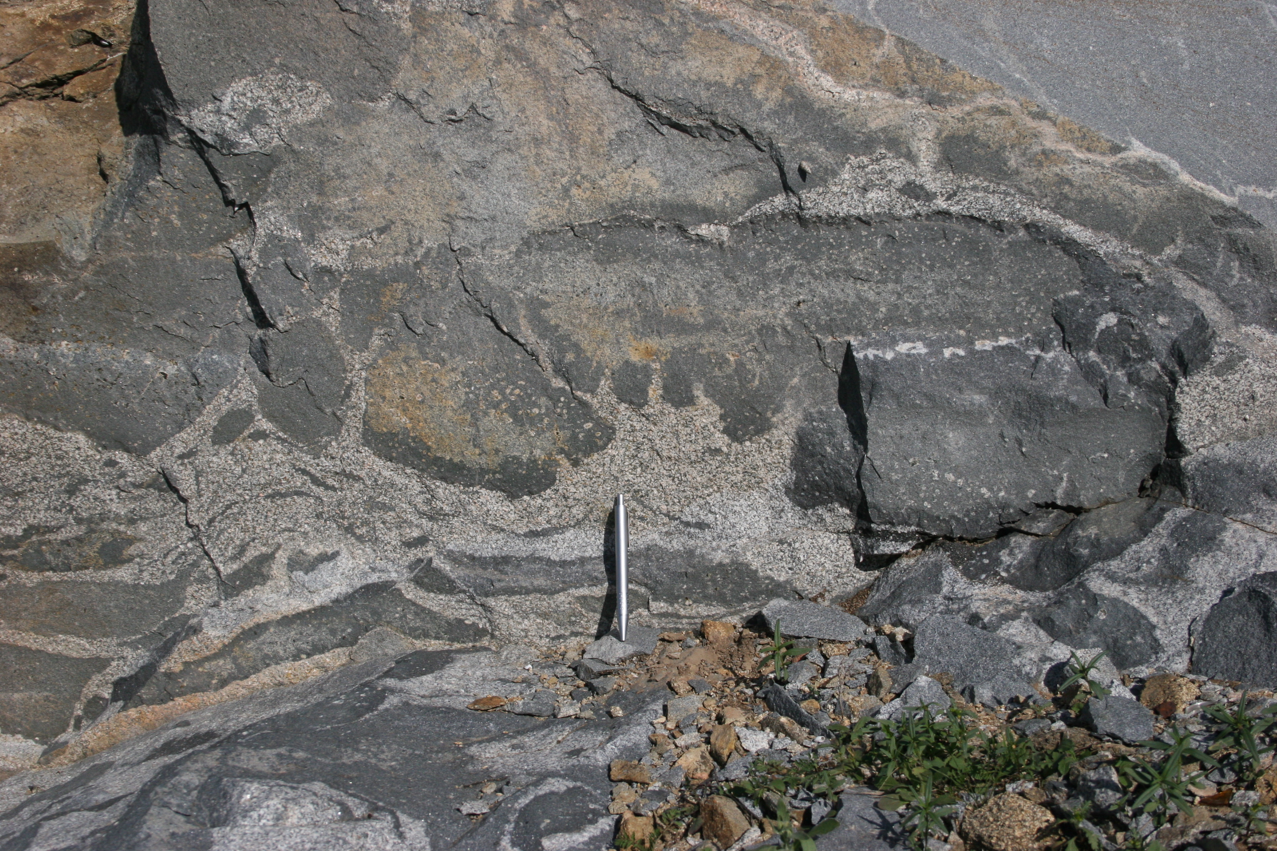
Folded basic dikes within a carbonatite matrix.
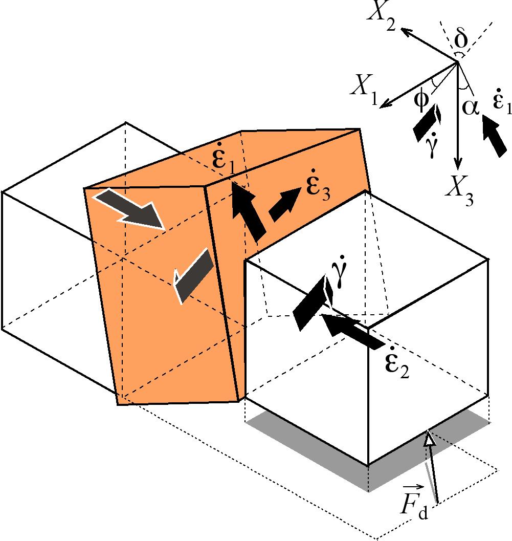 Model of triclinic
transpression with oblique extrusion (Carlos Fernández and
Manuel Díaz Azpiroz, work in progress).
Model of triclinic
transpression with oblique extrusion (Carlos Fernández and
Manuel Díaz Azpiroz, work in progress).
|
The content of my Ph.D. dissertation was focused on the structural
analysis of the Hiendelaencina shear zone (central part of the Variscan
Iberian Massif). Since then, the
study of natural ductile shear zones has been one of my priorities.
Areas of interest include the Iberian Variscan Massif (e.g., the
Hiendelaencina and the South Iberian shear zones) and the Basal Complex
of
Fuerteventura, Canary Islands (e.g., the Caleta de la Cruz and the
Punta del Peñón
Blanco shear zones, see an example below). More recently, I am
fascinated by the complexities of transpression and transtension zones.
Manuel Díaz Azpiroz (Universidad Pablo de Olavide) and I are
involved in the fight against transpression with oblique extrusion. The
fabric patterns resulting from this particular kinematic setting are
very similar to those observed in natural examples such as the South
Iberian shear zone.
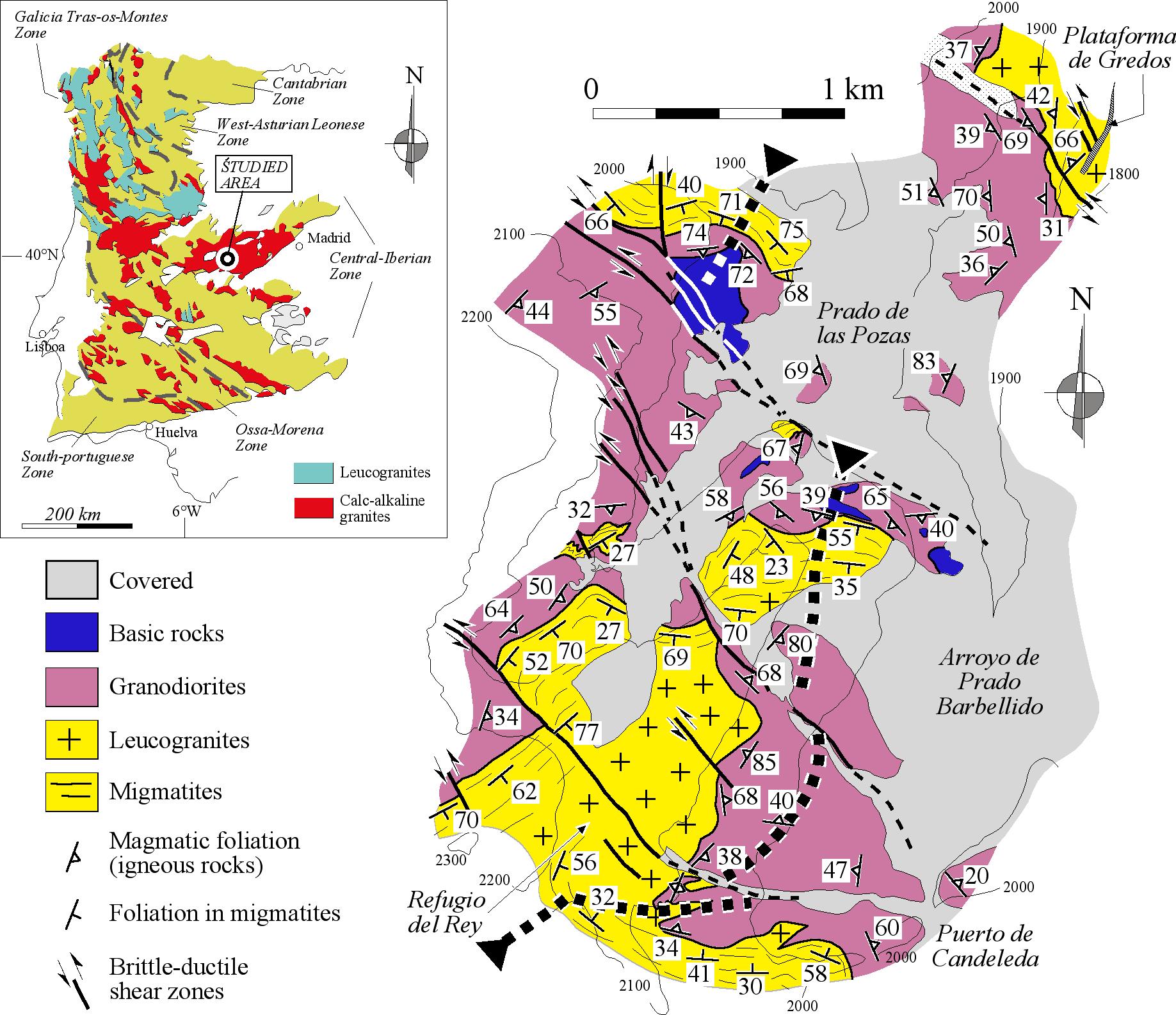
Detailed
map and structural data from the Punta del Peñón Blanco
shear zone (Fuerteventura, Canary Islands; see field photograph to the
left). Taken from Fernández et al. (1997, JSG).

Detailed field sketch
of the Punta del
Peñón Blanco shear zone (Fuerteventura, Canary Islands).
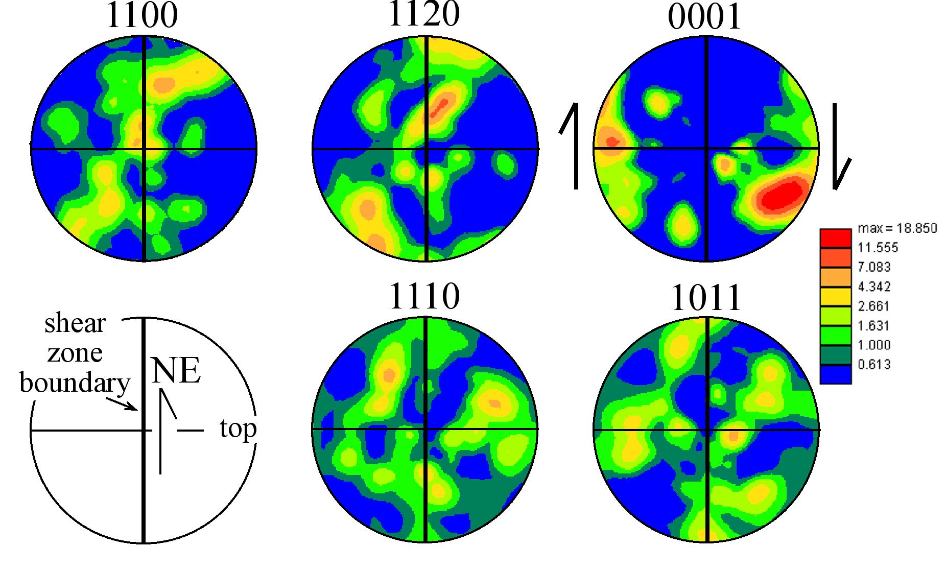
Structural data from
the Punta del
Peñón Blanco shear zone (Fuerteventura, Canary Islands).
Left: Equal area, lower hemisphere projection of mylonitic foliation
planes (great circles), stretching lineation (yellow squares) and minor
asymmetric folds (Z-shaped, red circles; S-shaped, orange circles).
Right: Equal area, lower hemisphere density plot of calcite [c] axes
from a sheared carbonatite.
|
|
Migmatites and granites
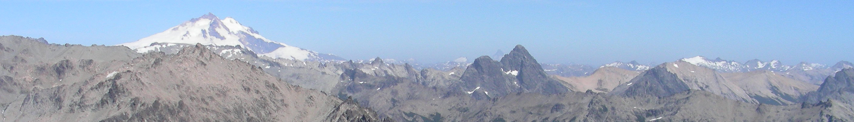
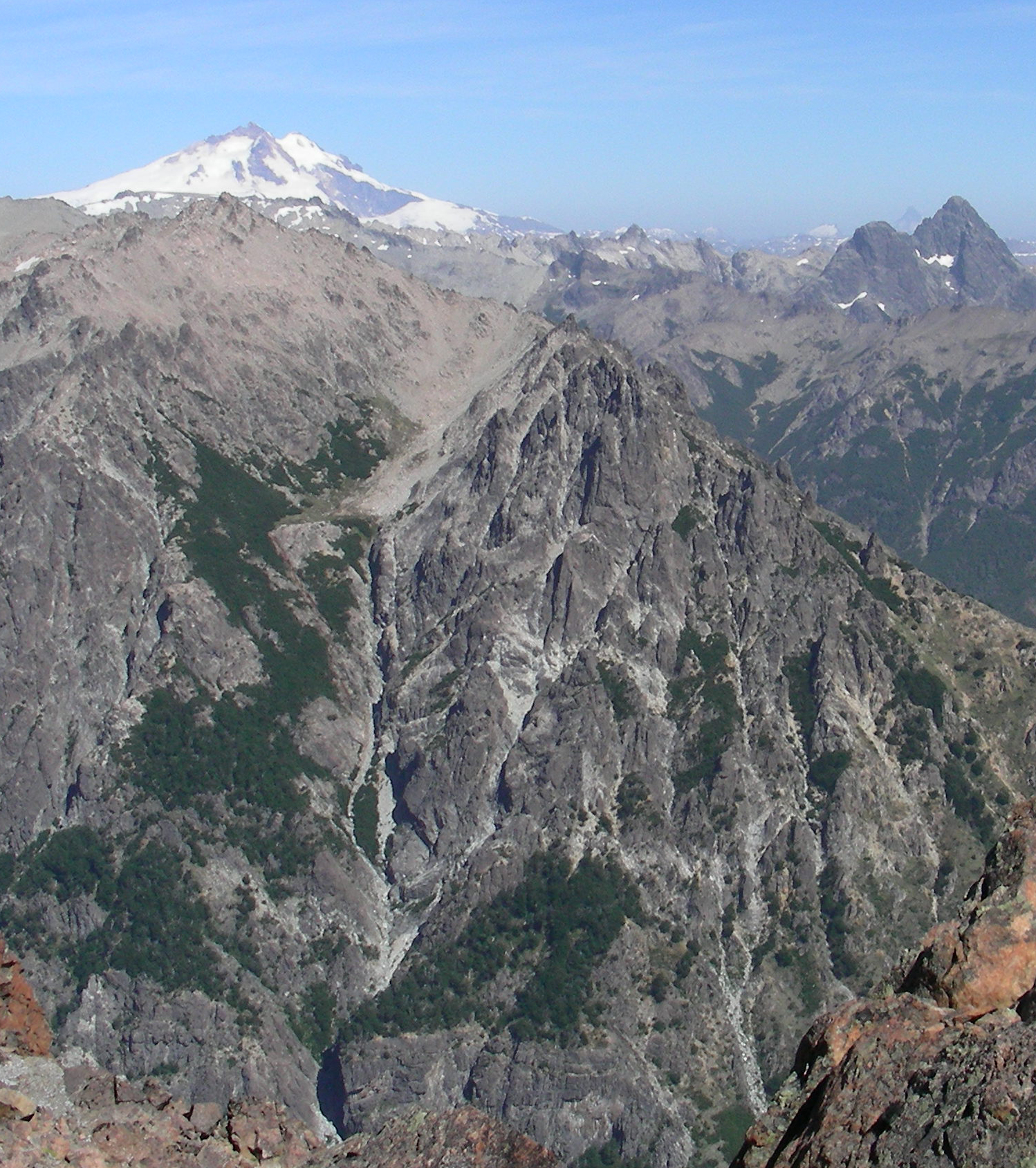
Mountains: Left, structural map of the central part of
the Gredos batholith (central Spain); right, the northern Patagonian
batholith (Argentina)
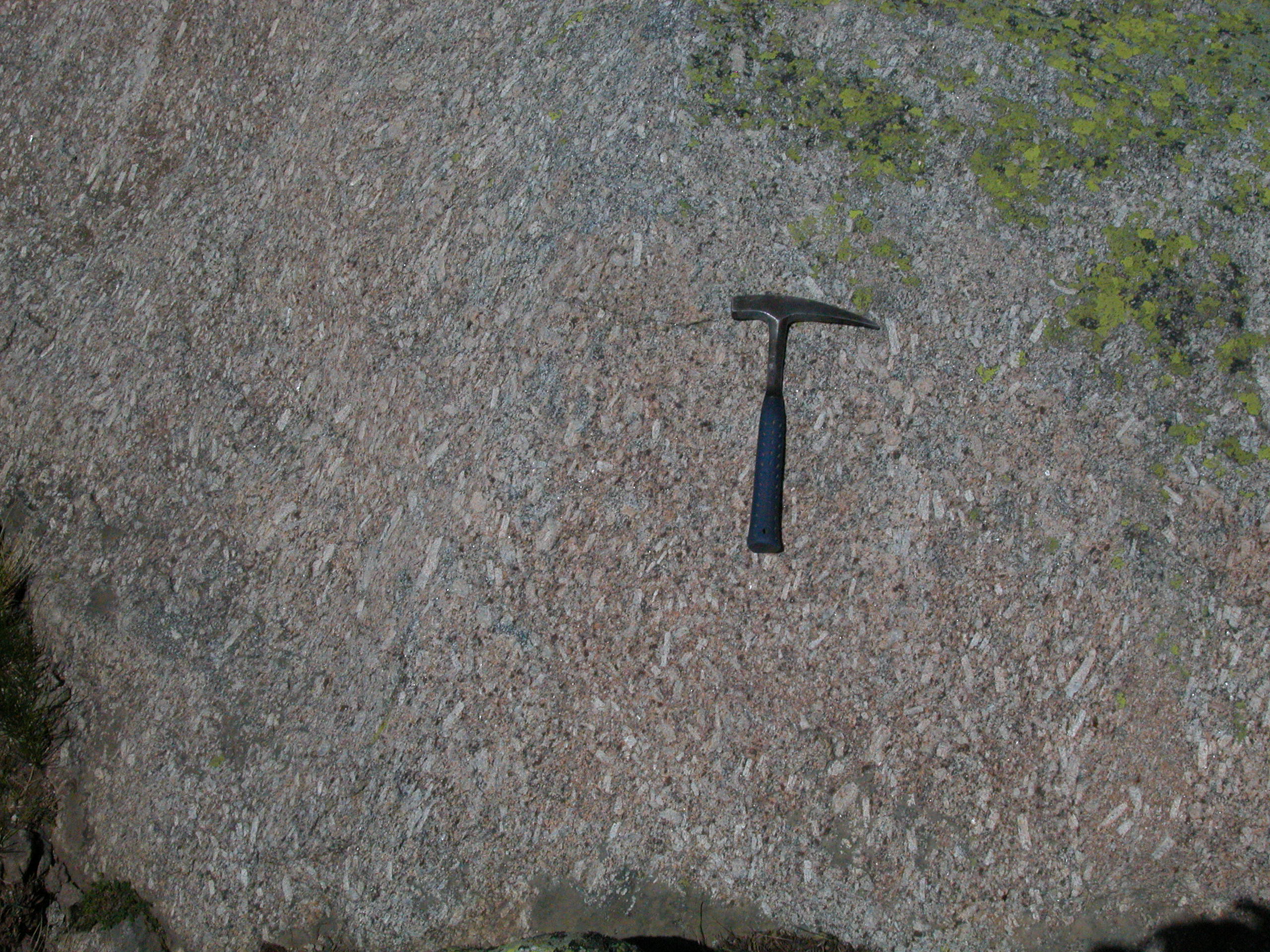
Outcrops: Left, frozen
interaction between mafic and felsic magmas in Gerena (southwestern
Spain); right, magmatic foliation in the Gredos batholith (central
Spain).
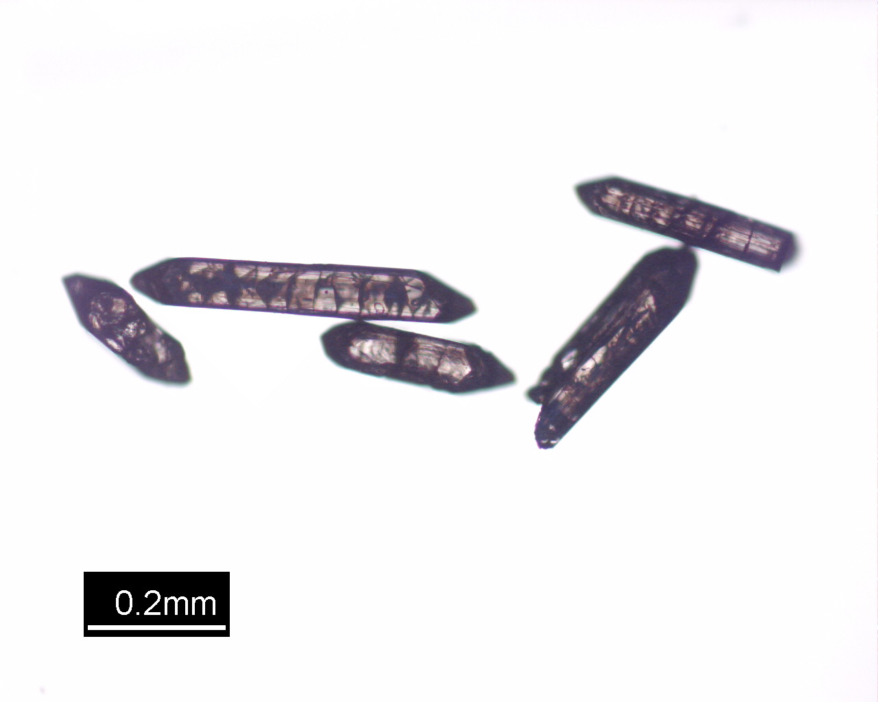
Microscope:
Left, quartz crystallographic fabrics (EBSD), subsolidus deformation in
a granodiorite; right, zircons from a granodiorite. Spanish Central
System.
|
My
first contact with the study of granites was immediately afer my
arrival to Huelva. I am in debt with Antonio Castro, the leader of the
Spanish granitologists, whose enthusiasm for granites defeated my
initial skepticism (What on earth a structural geologist can do with
granite plutons? I said). The brilliant words of Hans Cloos (Gespräch Mit Der Erde) also
helped. Not to mention the impressive amount of papers published on the
topics of melt segregation, ascent and emplacement appeared since the
90´s.
My own contribution to this research
field up to now has
been made possible thanks to the collaborative research effort of the
Huelva group: Antonio Castro, Iñaki Moreno-Ventas, Jesús
de la Rosa, Hassan El-Hmidi, Mohammed El-Biad, Susana López
Aparicio, Helena Chacón and Juan Díaz Alvarado.
Recent collaboration with portuguese colleagues has allowed the
enlargement of our research interest to migmatites and zircon
geochronology. M. Francisco Pereira and Patricia Moita (Universidade de
Évora), Martim Chichorro (Universidade Nova de Lisboa), and
José Brandão Silva (Universidade de Lisboa) constitute
the core of the portuguese team. In
Argentina we work in close cooperation with researchers of the
Universities of Buenos Aires (Víctor Ramos, Graciela Vujovich),
Córdoba
(Roberto Martino), Río Cuarto (Juan Otamendi) and Salta
(Raúl Becchio). Permanent
or occasional contacts with colleagues around the world has been of
great help. I can make mention here of Guillermo Corretgé, Jean
Luc Vigneresse, Alberto Patiño Douce, Ed Stephens, Graham
Rogers, Ian Williams and many others.
Areas of interest include the Variscan Iberian Massif (the Gredos
batholith, the Central Extremadura batholith, the Castilblanco de los
Arroyos batholith, the Sanabria region and the Évora-Aracena
metamorphic belt), the Lewisian Complex, and, recently, the northern
Patagonian batholith.
Click the publications
link of this page or the personal page of Antonio Castro to get
additional information on the results of this line of research. And you
don't want to miss the book here below!
|
Volcanism
and tectonics

The Canary
Archipelago. Northeasterly trade wind flow deflected by the islands
(image: NASA).
Dike swarms are one of
the main structures in the basal complexes of the Canary Islands. Left:
Dike swarm in Fuerteventura. Right: folded dike swarm in La Gomera.
Ductile and brittle
deformation structures are also common. Left: Caleta de la Cruz ductile
shear zone (Fuerteventura). Right: slickenside striations and
associated steps, La Gomera.
|
Relationships
between tectonics and volcanism are fascinating and their study
constitute a research field that has experienced a considerable
development over the past few decades. I have been
working in the Canary Islands since 1993. Deciphering the complex
processes that took place during the growth and emersion of these
islands is not an easy task. Fortunately, we rely on a
multidisciplinary
research group involving structural geologists (Encarnación
García Navarro, Manuel A. Camacho and Carlos Fernández,
Universidad de Huelva), petrologists and volcanologists (Ramón
Casillas, Agustina Ahijado, Margarita Gutiérrez, Julio de la
Nuez and Cande Martín, Universidad de La Laguna),
sedimentologists (J. Ramón Colmenero, Universidad de Salamanca),
and geochronologists and geochemists (Kadosa Balogh, Attila
Demény, Geza Nagy, Hungarian Academy of Sciences, Budapest).
Contributions to the knowledge of the geological evolution of the
Canary Islands have been presented in several papers and abstracts (see
publications).
As an example, here you can find some photographs and figures
illustrating our contribution. I hope that these results would also
help to clarify some
particular topics concerning the structural evolution of oceanic
volcanic islands.

The southern part of
Fuerteventura (looking southward).
|

Selected fault
measurement sites and deformation maps for the Miocene deformation
phases of Fuerteventura.
|
A detailed structural study (more 2990
than dikes and 1780 faults measured and analysed) allowed us
(Fernández et al., 2006, Tectonics) to define three Miocene
tectonic phases in Fuerteventura.
Our deformation group has proposed a new
model for the first stages of evolution of oceanic islands (Left, model
for the submarine and emersion stages of Fuerteventura,
Gutiérrez et al., 2006, GSA Bulletin). The mature, subaerial
evolution of the islands was also associated with the tectonic activity
(Right, initial stage of Miocene rifting of Fuerteventura,
Fernández et al., 2006, Tectonics).
|
Geoplanetology
The little companion of our planet (left)
has still many secrets to reveal to the experimented geologist.
Consider, for instance, the astonishing discovery of water on Mars
(right).
The old good maps of Mars were still in
use a few decades ago (map of Schiaparelli, 1877).
Yet important advances have been made in
our present-day space probe era. Structural map of the northern and
central segments of Tempe Fossae (northern hemisphere of Mars) by
Fernández and Anguita (2007, JGR).
|
Spring, 2003.
Francisco (Paco) Anguita
(Universidad Complutense de Madrid) sent me an intriguing Viking image
of a rather unusual graben floored by small folds and located to the
south of
Olympus Mons. This was the starting point of my own space race. I was
quickly captivated by the elegance of the Martian structures (grabens
and rifts, wrinkle ridges, lobate scarps, strike slip faults, etc. See
the figure bottom left). The low erosion rates and the declining
tectonic activity with time offer a fine preservation of very old
structures (> 3.5 Ga). They are directly comparable with the results
of analogue experiments, a task that is not so easy on Earth due to
vegetal cover, active erosion and sedimentation processes, and the
activity of successive tectonic phases. The quality and variety of the
images yielded by the modern NASA and ESA Mars missions, and the
availability of good topographical coverage (MOLA), are making Mars a
paradise for the structural geologists. Come on, a whole planet is
waiting for you!
Collaboration with my colleagues of the Seminario de Ciencias Planetarias
(Universidad Complutense de Madrid, I would like to make mention in
particular of Paco Anguita and Javier Ruiz) has been fruitful. We have
investigated the similarities between Thaumasia Highlands and
terrestrial orogenic belts (see below), the depth to the
brittle-ductile transition in the Amenthes and Southern Thaumasia
regions, and its implications for the estimation of the heat flow, and
the crustal rheology and stratification during the Late Noachian and
Early Hesperian periods (≈ 4.0-3.5 Ga). Last, but not least, Paco has
finally convinced me to start studying a lowland region of Venus. I
hope to have something to show about Venus soon, before I get mad
(Venus, Mars and Earth are so distinct and so similar at the same time,
that no one can jump from one to another without going mentally ill).
 Comparison between the structures observed
at Nectaris Fossae (eastern Tharsis region, Mars) and terrestrial
examples (from Anguita et al., 2006, Icarus). Top: geological
cross-sections showing the suggested lateral transition from
thin-skinned to thick-skinned tectonics in Nectaris, similarly to the
well documented architecture of terrestrial orogenic belts (e.g.,
Pyrenees). Down: rhomb-horst structures in Nectaris (left) and Earth
(right). The geometries are interchangeable, which strongly emphasizes
the importance of strike-slip displacements on Mars.
Comparison between the structures observed
at Nectaris Fossae (eastern Tharsis region, Mars) and terrestrial
examples (from Anguita et al., 2006, Icarus). Top: geological
cross-sections showing the suggested lateral transition from
thin-skinned to thick-skinned tectonics in Nectaris, similarly to the
well documented architecture of terrestrial orogenic belts (e.g.,
Pyrenees). Down: rhomb-horst structures in Nectaris (left) and Earth
(right). The geometries are interchangeable, which strongly emphasizes
the importance of strike-slip displacements on Mars.
|
|